


While I’m a firm believer that hiking is all about connecting with nature and unplugging from technology, there’s no denying that certain apps can enhance the experience. These tools can improve safety, provide useful knowledge, and make planning your next adventure easier. Here’s a roundup of my favorite hiking and outdoor apps that help me explore the outdoors with confidence.
AllTrails
If you’re on the hunt for a nearby hike, AllTrails is the app to have. It boasts a vast database of trails, complete with detailed information such as difficulty, length, elevation, and more. You can filter trails based on your preferences or use the map function to discover hikes close to your location. The app is free to use, but the premium version (AllTrails Pro) unlocks offline map downloads, GPS tracking, and other handy features, all for $2.50 a month when billed annually.
REI Hiking Project
Similar to AllTrails, REI’s Hiking Project helps you discover trails, but it also emphasizes community input. With more local hikers contributing their own trail reports and updates, it offers a more grassroots approach. The app’s map feature is particularly useful, as it allows you to see where your hike intersects with other maintained trails, making it easier to plan your route. While it has fewer trails than AllTrails, it’s a great resource for discovering less-known hikes.
Strava
Strava is my go-to app for tracking outdoor activities, especially hiking and running. While it offers basic maps, its real strength lies in tracking performance. I use it to log my runs, monitor elevation changes, and track my pace, split times, and other metrics. Strava also allows you to share your hikes with friends and check out what others are doing in your area, making it a fun and social tool for outdoor enthusiasts.
Guthook Guides
For long-distance hikes, Guthook Guides is an indispensable app. With detailed maps, points of interest, and user-generated updates, it serves as a pocket-sized guidebook for well-known thru-hikes like the Pacific Crest Trail and Appalachian Trail. You can track your progress, find water sources, and get info on nearby towns. Whether you’re tackling a major trail or a smaller route, Guthook is an essential companion for any backpacker.
OnX Hunt
Although OnX Hunt was initially designed for hunters, it’s also incredibly useful for hikers, especially those exploring unfamiliar areas. The app provides detailed maps with features like landowner boundaries, GPS tracking, and offline functionality. It also allows for distance measurement, waypoint tagging, and offers satellite imagery alongside traditional topo maps. While it’s on the pricier side, OnX is an excellent tool for hikers planning complex routes or venturing off the beaten path.
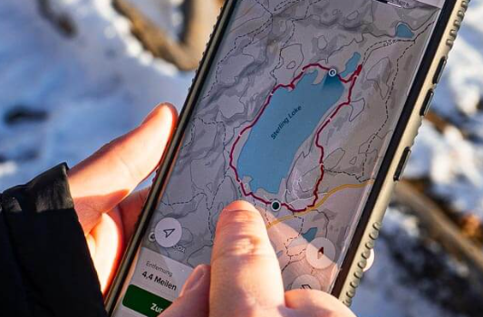
Gaia GPS
Gaia GPS is my top choice for downloading detailed topo maps. While it’s not as focused on finding new hikes as AllTrails or Hiking Project, it excels in route planning and map downloads. The app offers a variety of map sets, including USGS Topo and Satellite views, making it versatile for different outdoor needs. The premium version expands your map options even further and includes custom map layers. Gaia GPS is particularly useful for hikers who need robust map functionality and offline capabilities.
Seek by iNaturalist
If you’re interested in the flora and fauna around you, Seek by iNaturalist is a must-have app. It uses your phone’s camera to help identify plants, animals, and fungi in real-time. As you explore, you can contribute your findings to the global iNaturalist community, making it a great tool for nature enthusiasts. The app also includes challenges and badges, encouraging users to learn more about the ecosystems they’re in.
Peak Visor
For those curious about the peaks and ridgelines around them, Peak Visor is an excellent app. It allows you to snap a photo of a mountain or peak, and the app will identify it, providing key details about its name, location, and often hiking routes. The app’s advanced 3D maps offer a detailed view of the land around you. While I don’t use it all the time, it’s a handy tool when I find myself staring at a distant peak and wondering what it is.
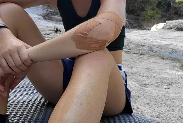
First Aid by American Red Cross
The First Aid app by the American Red Cross is a practical tool to have when hiking, especially in remote areas. While it’s not a replacement for actual first aid training, it’s an excellent reference for handling emergency situations. The app provides step-by-step instructions for treating injuries such as cuts, sprains, allergic reactions, and more. Having it on hand could be invaluable if you find yourself in an emergency.
Conclusion
Technology can be a powerful tool to enhance your hiking adventures. These apps not only make planning easier but also provide valuable insights and safety features to ensure you have the best outdoor experience possible. Whether you’re looking for a new trail, need detailed maps, or want to identify plants, these apps are all worth having on hand for your next adventure.